Shameless plug ahead! This article was (probably) written in the course of building Geofolio, which is a project I've been working on that automagically generates factsheets for any place on Earth. It contains lots of maps and charts, all powered by open data. Check it out at https://geofolio.org/ or follow @geofolio on Twitter for news and updates.
This weekend news hit of a tailings dam collapse at a mine owned by Vale in Brumadinho, Brazil. From the initial reports and photos coming out of the area the damage looked immense.
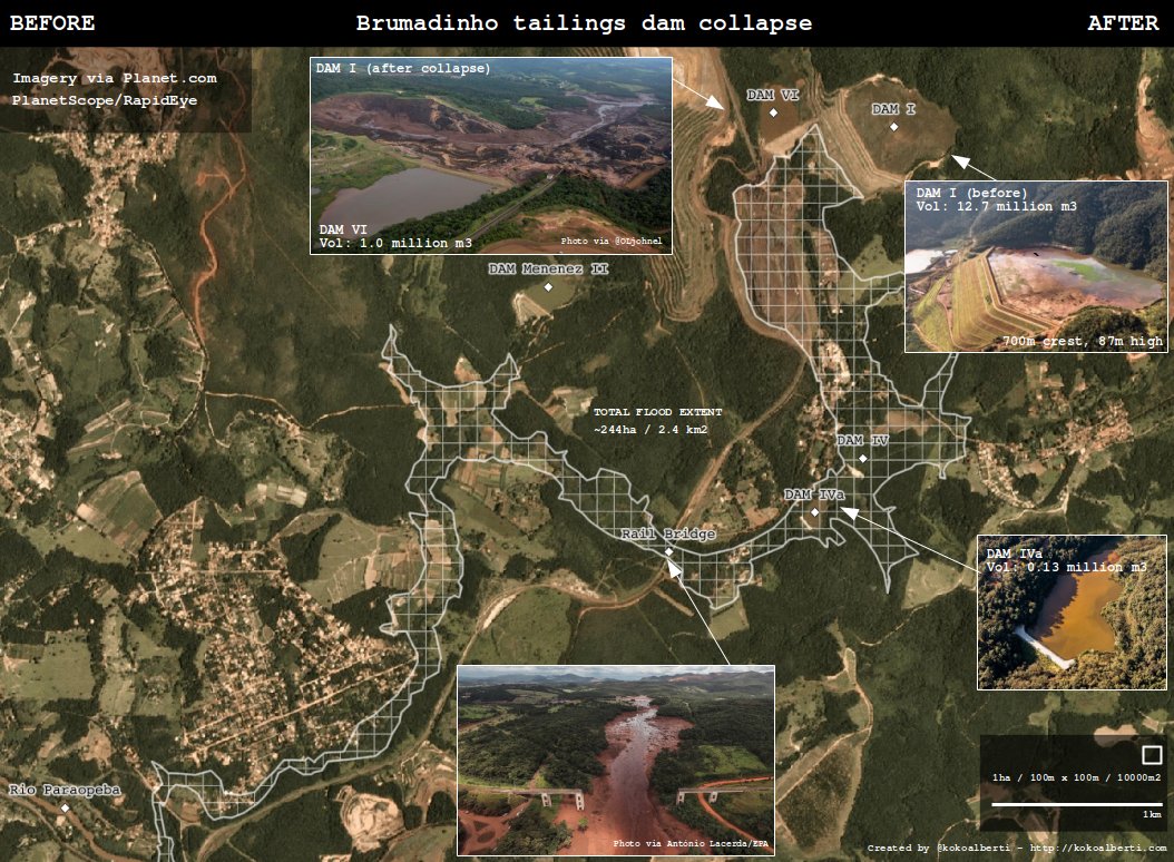
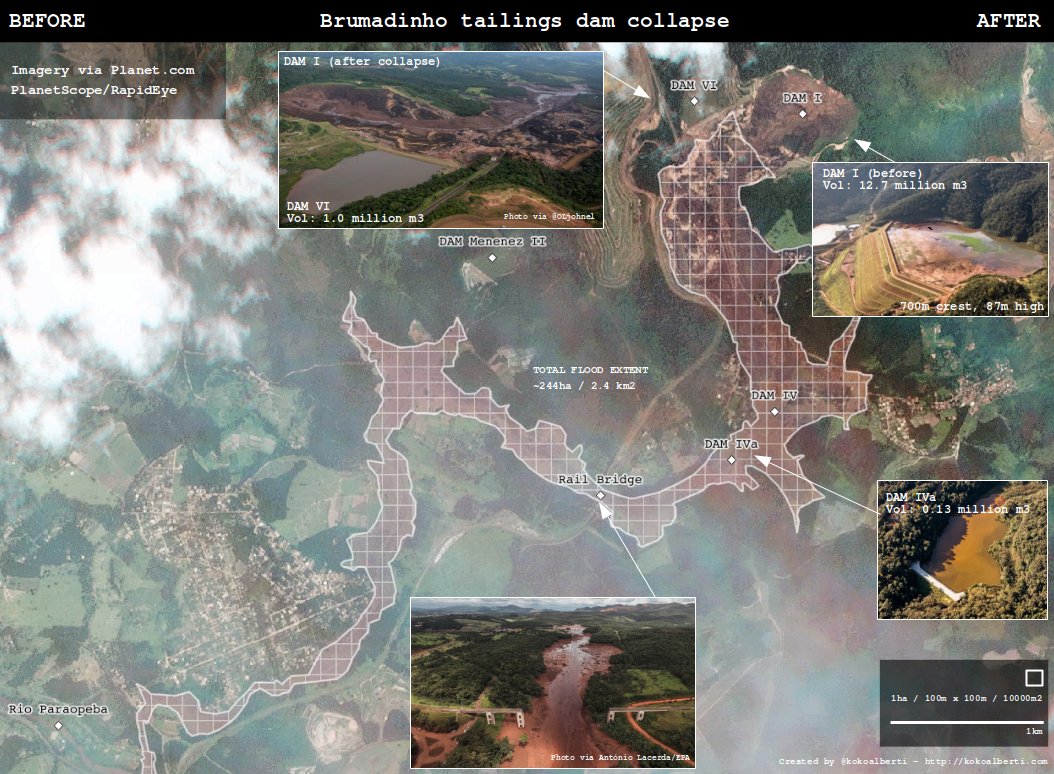
Because news reports were sparse on geospatial details that show the extent of the disaster, I started looking around for some data and put together this before/after visualization based on imagery by Planet.
The extent of the affected area looks to cover around 240 hectares (2.4sq.km), and the flood has destroyed large swaths of infrastructure in its path, including buildings, bridges, roads, and a smaller reservoir nestled in the valley downstream. Here are the before and after images, each white square is an area of 100 by 100 meters:
You can download the shapefile for the damage extent here (7Kb). For access to the satellite imagery it is probably best to contact the people at Planet directly or sign up for their services.
There is also a presentation from Vale online with more details (photos, statistics, risk classifications) on this and other tailings dams in the surrounding area.
Thanks for reading! Get in touch via @kokoalberti for any questions or comments. I also post new articles there when they are first published.
Notes and References
Update 28 Jan: Updated the images with some more details, added additional dams on the maps.
Update 28 Jan: Editing for less text, fix typo in image header, added presentation link.